News
See our LinkedIn posts
New Year, new website!
Instruments
Fixed position or handheld optical ecological water quality instruments
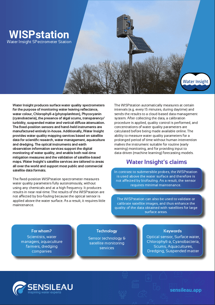
WISPstation
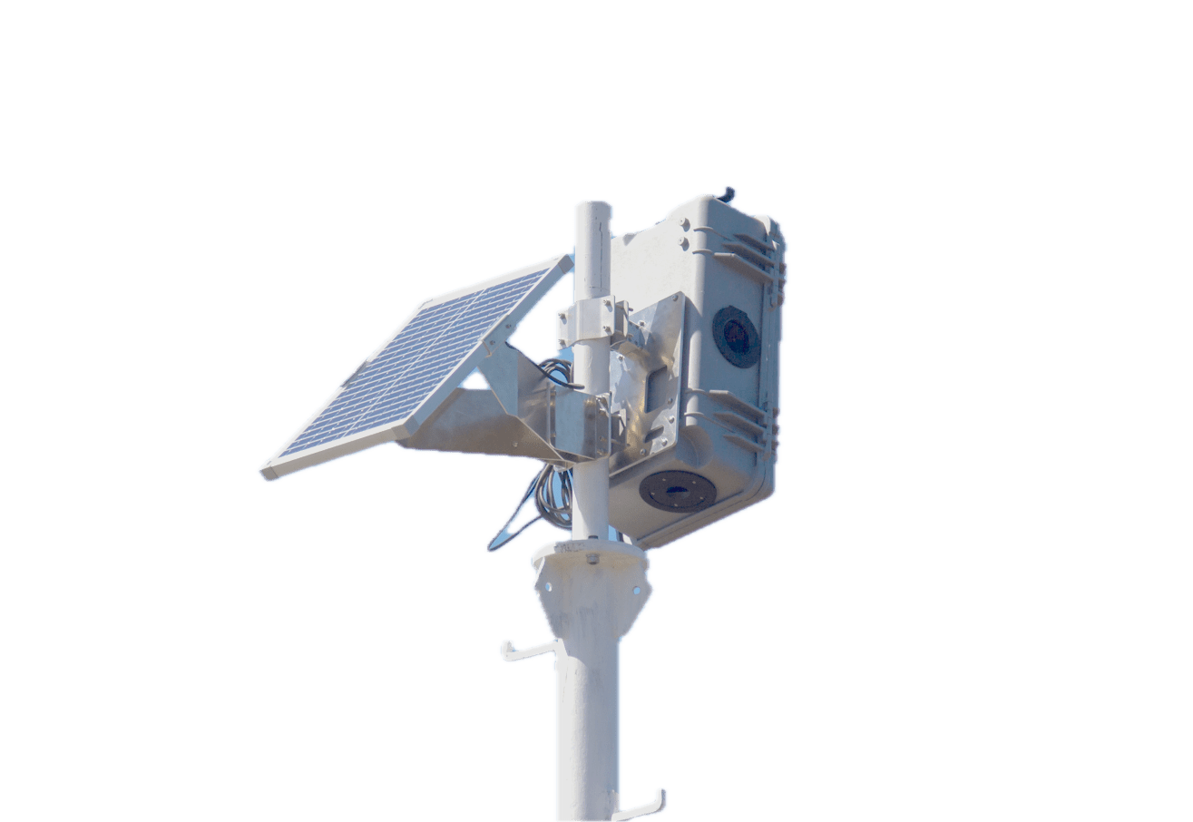
A difgital instrument for water quality
High frequency measurements for more insight in the ecological status, bathing water information and a coupling with new techniques such as monitoring with satellites.... Where do you want to go with your water quality monitoring? The WISPstation optical measurement station does all of these.
Read more
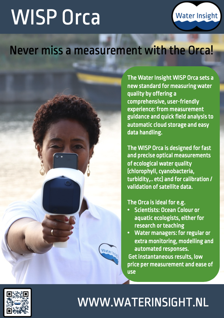
WISP Orca
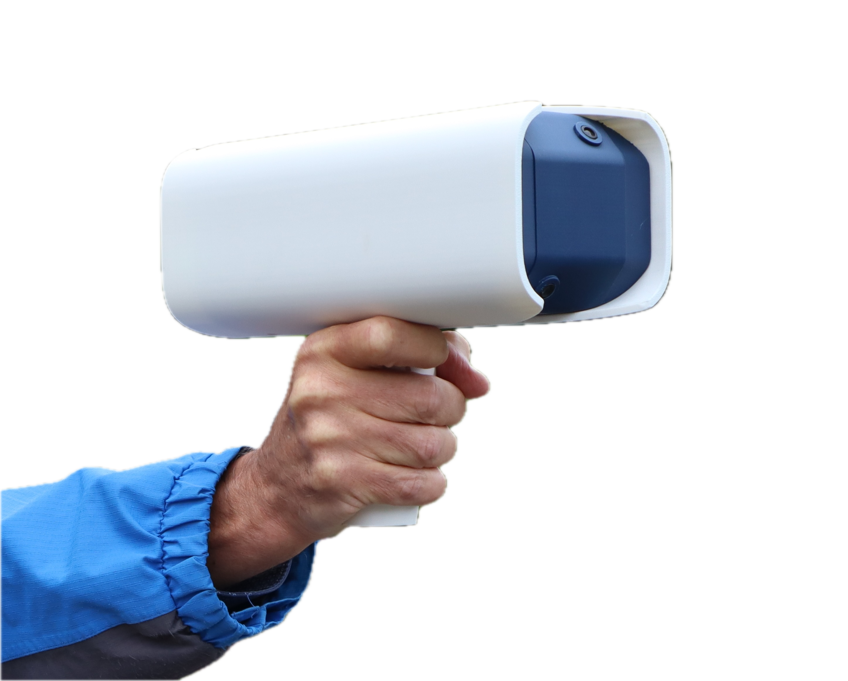
Never miss a measurement with the Orca!
The WISP Orca is an agile and user-friendly instrument, designed for fast and precise optical ecological water quality measurements (chlorophyll, cyanobacteria, turbidity, etc) and for calibration/validation of satellite data. Building on the robust experience of our well known WISP-3 (retired) and WISPstation, the WISP Orca incorporates several significant improvements.
Read more
Solutions
We provide solutions for Research, Water Management, Aquaculture and Dredging
Cyanobacteria and (harmful) algal blooms
Our first project at Water Insight was about mapping HABs in the North Sea and 20 years later we are still providing algal bloom information services.
These services are about inland water cyanobacterial blooms and about Red Tides, Phaeocystis and other nuisance species at sea. Where applicable, we can provide a potential bloom warning service based on the occurence of upwelling processes.
Our latest EU LIFE project CYANOBLOOM aims to demonstrate a solution for early detection of toxic cyanobacteria blooms in public water supply reservoirs through a combination of remote monitoring (i.e by means of data retrieved from public and private satellites) and on-site measurements (i.e hyperspectral field measurements with genetic analysis of collected samples).
Read more
Aquaculture and fisheries
Water Insight is supporting the Dutch aquaculture sector for many years with Earth Observation information in projects and commercial services.
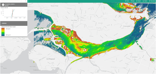
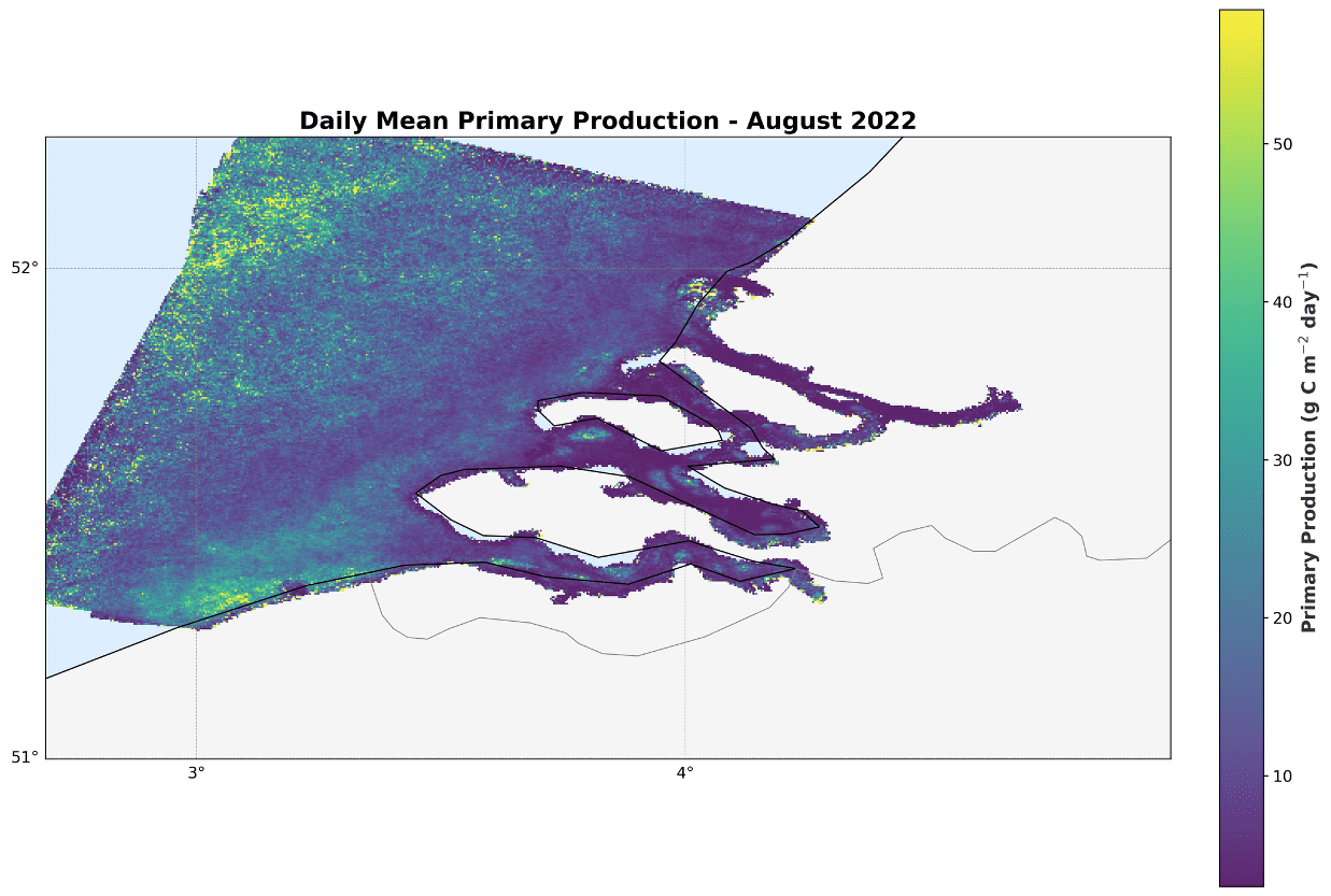
Aquaculture and fisheries companies are currently making the transition from experience based to data driven decision making. We provide ecological status maps, including for instance Primary Production information. Together with our partners, we also work on shellfish growth models.
Read more
Aquatic vegetation mapping
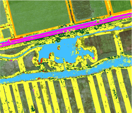
For a number of Water Boards in the Netherlands we provide aquatic vegetation mapping services based on Earth Observation data, usually VHR data from the Satellietdataportaal. Using machine learning AI models different vegetation classes can be identified.
Read more
Dredging monitoring
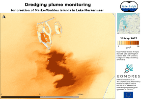
Monitoring dredging plumes using Earth Observation data has recently gained interest as a cost-effective way for dredging projects to check their compliance to environmental restrictions.
Read more
About us
Meet the Water Insight Team

Dr. Steef Peters

Dr. Annelies Hommersom
Semhar Ghezehegn, MSc
Lazaros Spaias, MSc.
Yoram van den Oetelaar
Contact
Use our contact form or drop by!
Water Insight visiting address
Fahrenheitstraat 42
6716BR Ede
The Netherlands
Monday - Friday 900 - 1700